LIG-Finder: an interactive and personalized web-GIS application for multi-criteria land parcel exploration, analysis and visualization
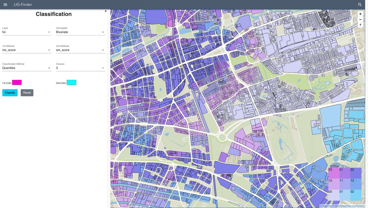
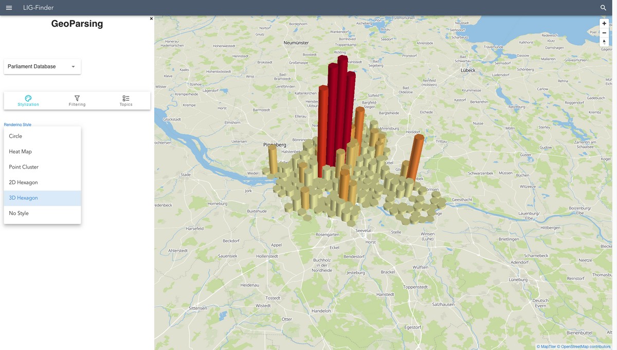
HafenCity Universität Hamburg, Digital City Science, 2022In a research cooperation between The Digital City Science (DCS) group of HafenCity University Hamburg (HCU) and the Hamburg State Agency of Real Estate and Property Management (LIG), a multi-criteria, interactive, and personalized web-GIS application was developed that facilitates the targeted identification of land parcels for real estate development, and supports related decision-making processes by analyzing inherent features of land properties, using open-source geospatial tools and functionalities. It also provides interactive visual exploration tools in form of 2D and 3D cartographic styles by using webGL capabilities.
Links
- https://ligfinder.digitalcitys...
- https://github.com/digitalcity...
- https://ariel505.github.io/lan...
Authors
Project Partner
Landesbetrieb Immobilienmanagement und Grundvermögen (LIG) Hamburg