Streetonomics A form of computational social science that studies human behavior and cultural trends through the quantitative analysis of street names
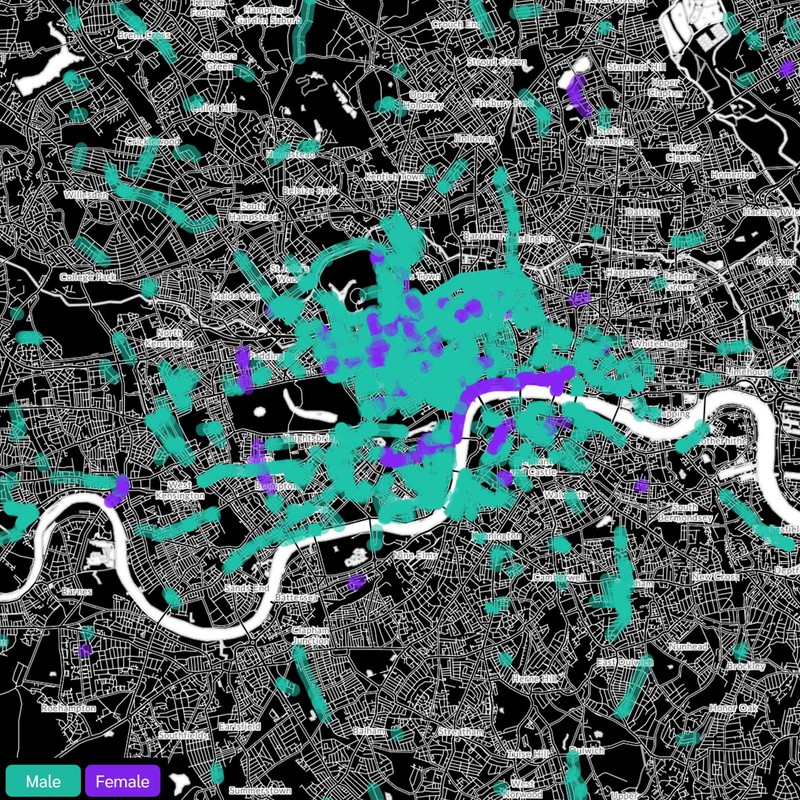
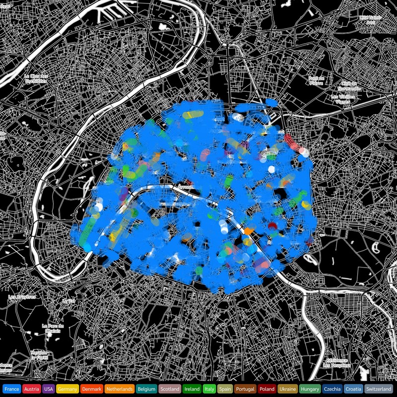
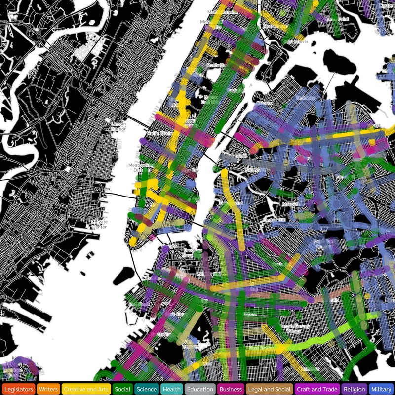
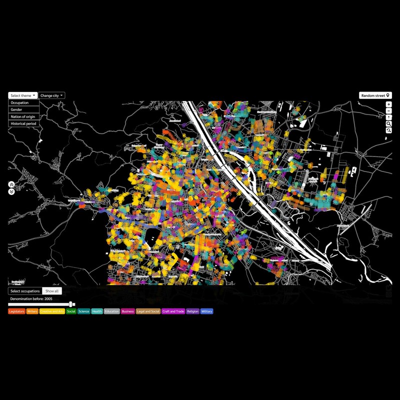
Nokia Bell Labs, 2020Throughout history, maps have been used as a tool to explore cities. They visualize a city’s urban fabric through its streets, buildings, and points of interest. Besides purely navigation purposes, street names also reflect a city’s culture through its commemorative practices. Therefore, cultural maps that unveil socio-cultural characteristics encoded in street names could potentially raise citizens’ historical awareness. But designing effective cultural maps is challenging, not only due to data scarcity but also due to the lack of effective approaches to engage citizens with data exploration. To address these challenges, we collected a dataset of 5000 streets across the cities of Paris, Vienna, London, and New York, and built their cultural maps grounded on cartographic storytelling techniques. Cultural maps engage uses and allow them to discover distinct patterns in the ways these cities are gender-biased, celebrate various professions, and embrace foreign cultures.
Links
Authors
Project Partner