General Theory of Urbanization
300.000 Km/s, 2017
Ildefons Cerdà published in 1867 the General Theory of Urbanization. In this book, the ?science of making cities? became a new discipline with a broad economic, social and cultural impact on the lives of people in the city. On the 150th anniversary of its publication, the first translation into English has been published with the aim of expanding knowledge of Ildefons Cerdà?s work
and fostering the debate about the process of future urbanization.
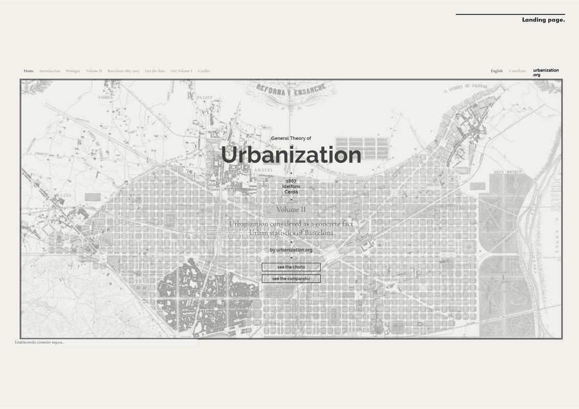
The book has two volumes. The first one sets the basis of the Theory and the second contains an exhaustive statistical description of the city of Barcelona in 1867, that has been transformed into interactive graphics and an open data platform of the Big Data of the nineteenth century.
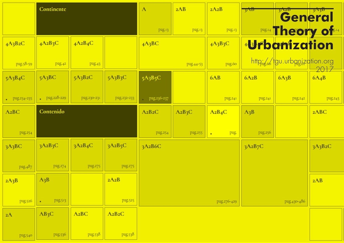
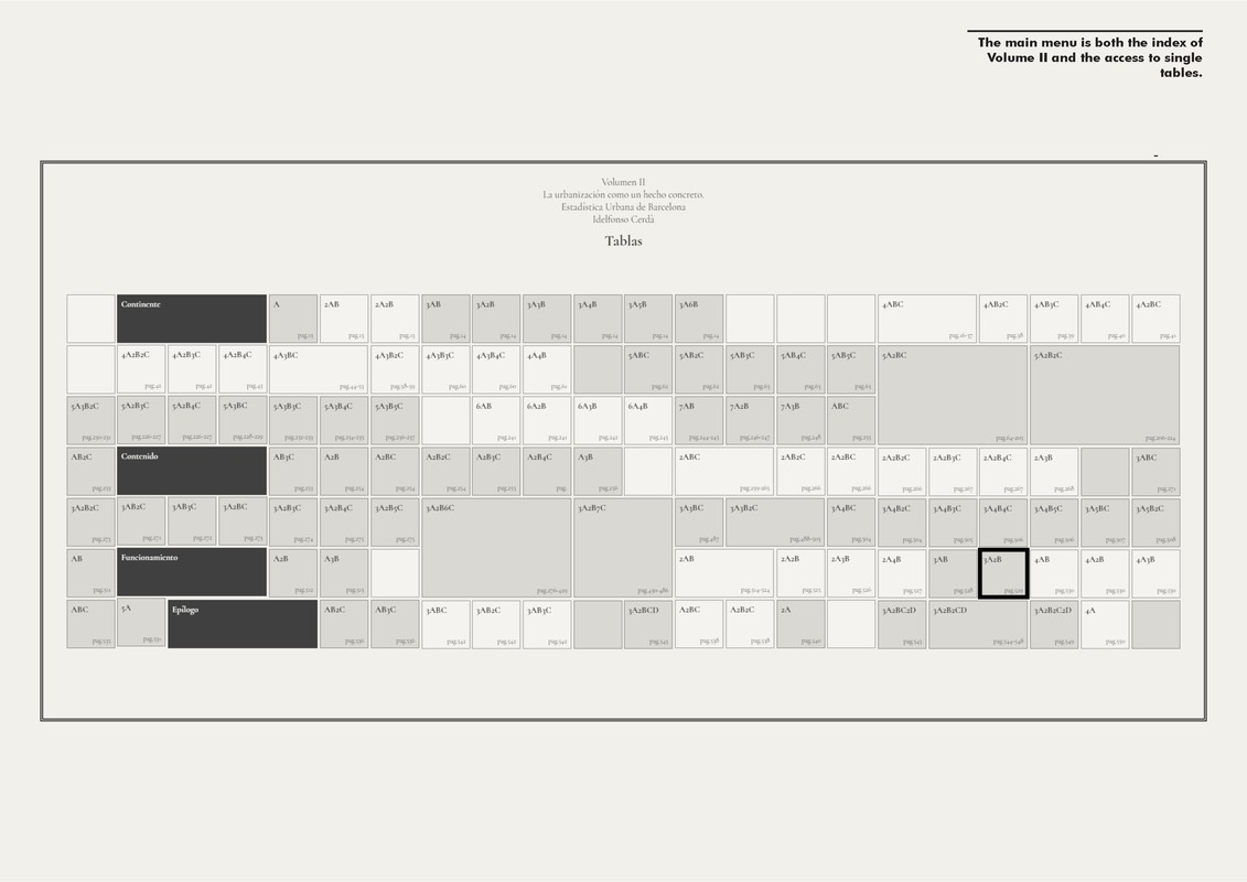
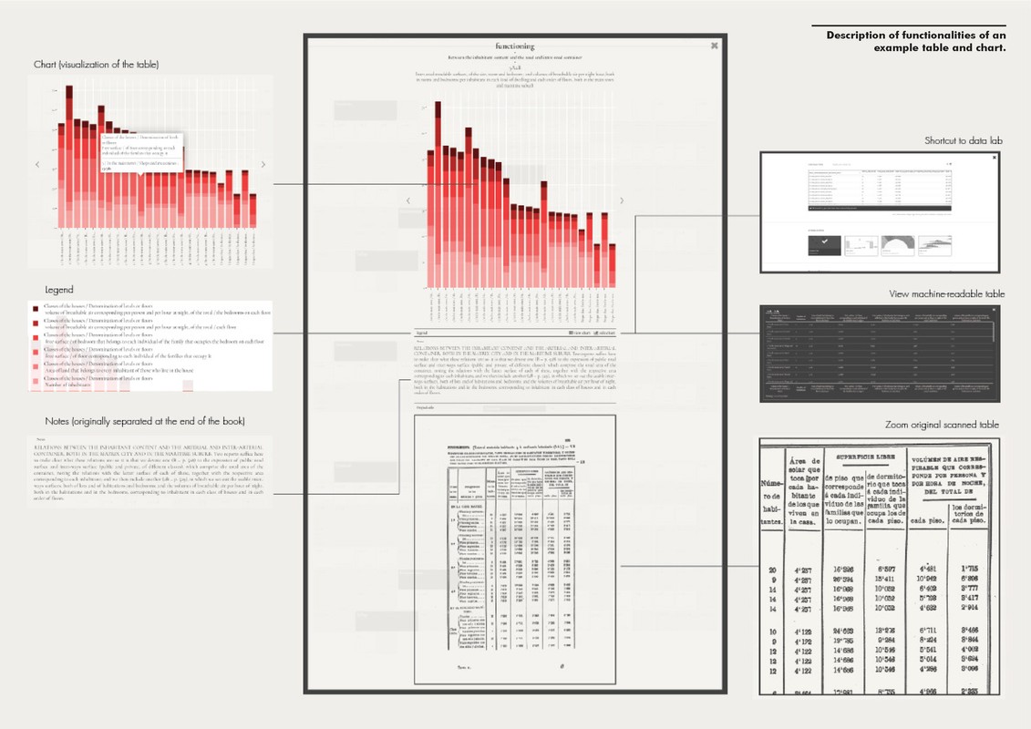
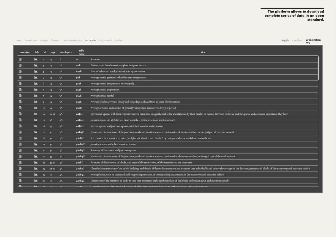
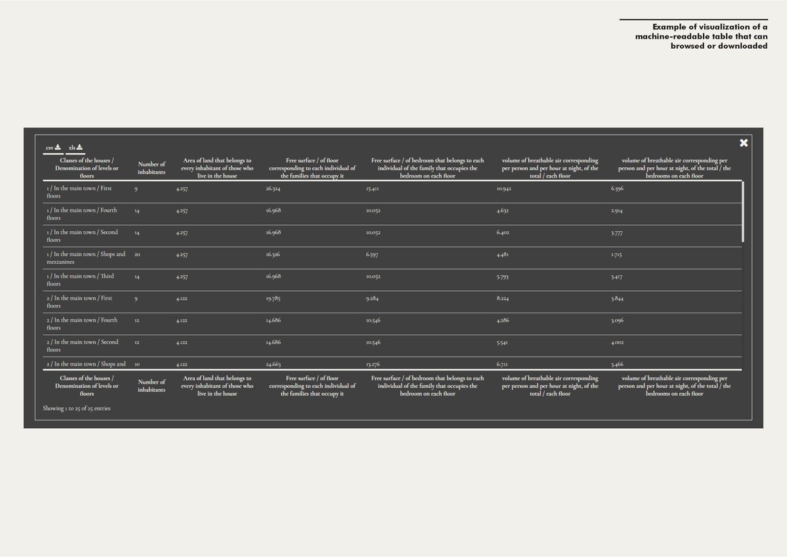
The platform has three main sections. The first one is an interactive data visualisation of more than 700 pages and 100 tables that have been previously digitised and translated into machine-readable format. The main menu works as a general index giving an overview of the global content structure and enabling access to each chapter or individual statistics. The information has
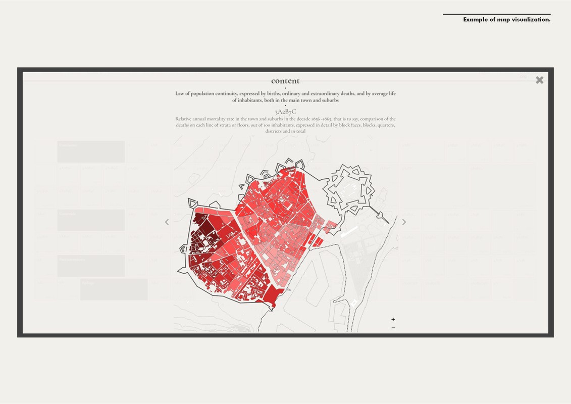
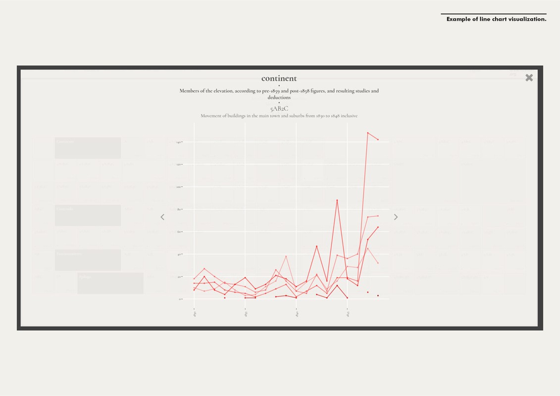
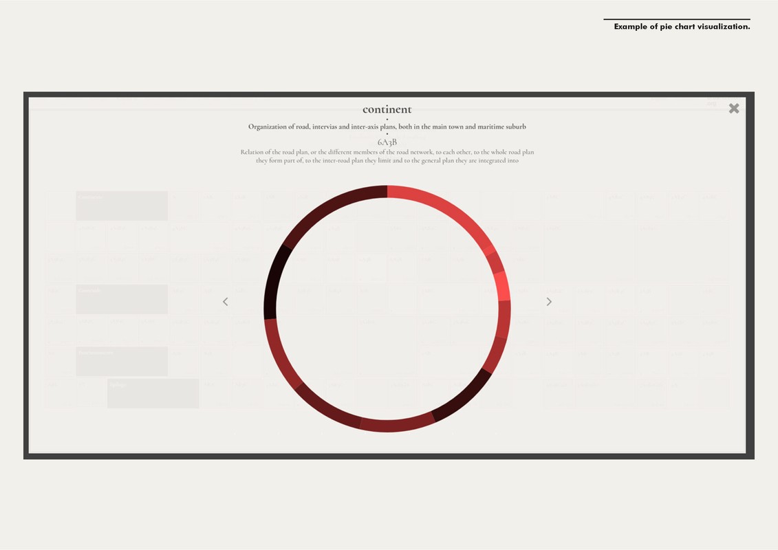
been visualised according to different data types -bar charts, line charts, pie charts and maps all of them with different level of aggregation-, providing a context and a description to each table (putting together several data that was unstructured in the original book).
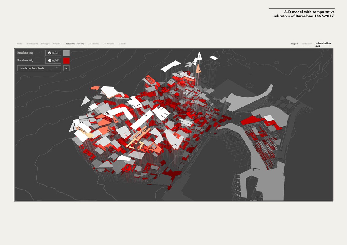
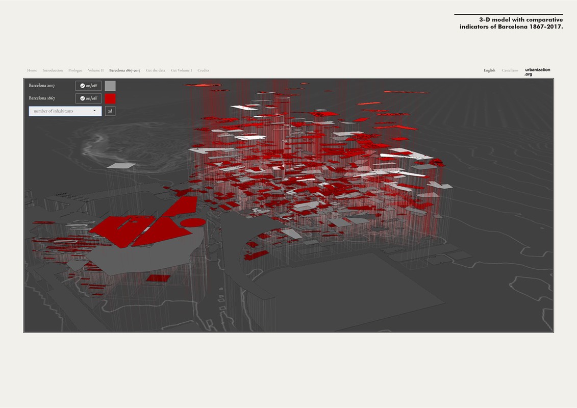
The second part consists of a 3-D modelling of urban indicators (number of inhabitants, number of buildings per type, mortality rate, among others) that enables to compare Barcelona during 1867 with the current city. The original book includes several tables that present aggregated data at the level of a city block. It has been necessary to digitise ancient cartography of the central
district of Barcelona to match this information and give a spatial component to the data.
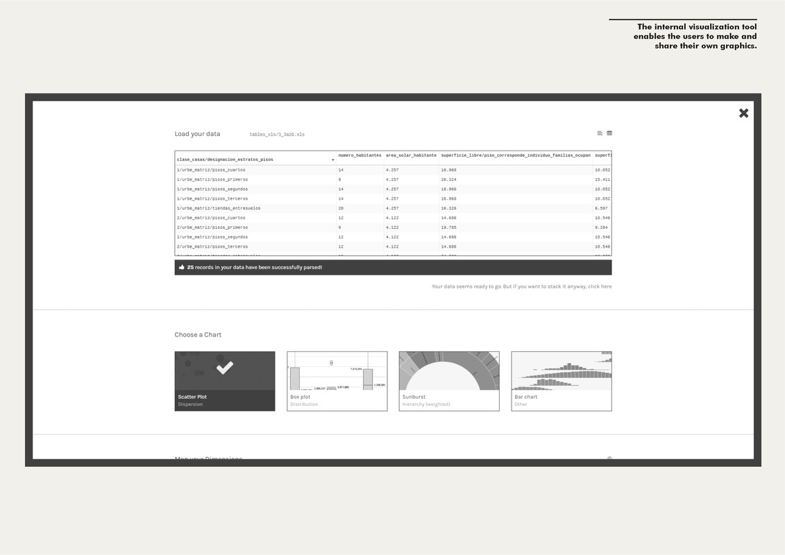
Finally, as the project has a strong commitment to openness, the third section of the platform conatins a complete series of data sets published under open standards. An internal visualization tool enables the users to make and share their own graphics.
The project emphasizes the role of urbanism as a science as Cerdà conceived it. It makes his theoretical work accessible for all through data visualization and puts Cerdà?s digitized legacy in the hands of the scientific community to promote knowledge of his work and urbanism in general.
Authors
Project Partner
Editors: Institute for Advanced Architecture of Catalonia (IAAC) ACTAR In association with: Diputacion de Barcelona Generalitat de Catalunya. Incasol In collaboration with: Centre de Cultura Contemporània de Barcelona (CCCB) Bloomberg Philatrohpies